
Whereas it might have been more in line to devote this post to discussion of the European Union referendum, here instead is an account of a college trip to some medieval hotspots in Beverley.
That we should have been on such an excursion at all was an oddity – the locations featured were entirely focused on Medieval History, yet the Modern History class were allowed to tag along. This being the penultimate day of the term – and there being no more history lessons in the remainder of the timetable – the educational focus of the outing was light. No worksheets were distributed nor notes taken, though teachers occasionally stopped to explain the historical significance of the local landmarks.

The tower at Beverley Westwood.
The first such place was the Black Mill at Beverley Westwood. It one of two survivors of the five windmills which once stood in Beverley, and lost its sails in 1868. The Westwood is one of few remaining areas of common land in England, meaning that residents have maintained their traditional rights to use the turf for grazing cattle or collecting firewood – indeed there were several cows (and cowpats) there to greet us as we ambled across. In the modern era, visible to us on our visit, the territory is also used for a golf course and for Beverley Racecourse.
Beverley escaped the Harrying of the North because the Normans knew of the area’s religious past. John of Beverley – then the Bishop of York – was believed to have performed miracles. He also founded Beverley’s first building, a church dedicated to St John the Evangelist, though this was abandoned in the Viking invasion. The settlement became a large town and was granted borough status in the twelfth century with special interest in trading wool and leather. In the late fourteenth century it became the tenth-largest town in England, having continued to grow despite the effects of the Black Death, the Peasants’ Revolt and the Hundred Years’ War which stunted the development of other parts of the country.
Having ambled across the turf, exploring the dips and bumps in the ground, we were lectured on the habitation of the settlement in the middle ages. We also were dispatched around this area to uncover a large metal hook in the ground. This was used for the medieval sport of bull-baiting: A bull would be attached to the hook while dogs were sent to attack it. Spectators would bet on the time taken for the bull to die and the number of dogs slain in the process. There was also a practical purpose – the adrenaline rush in the last moments of life improved the taste of the beef.
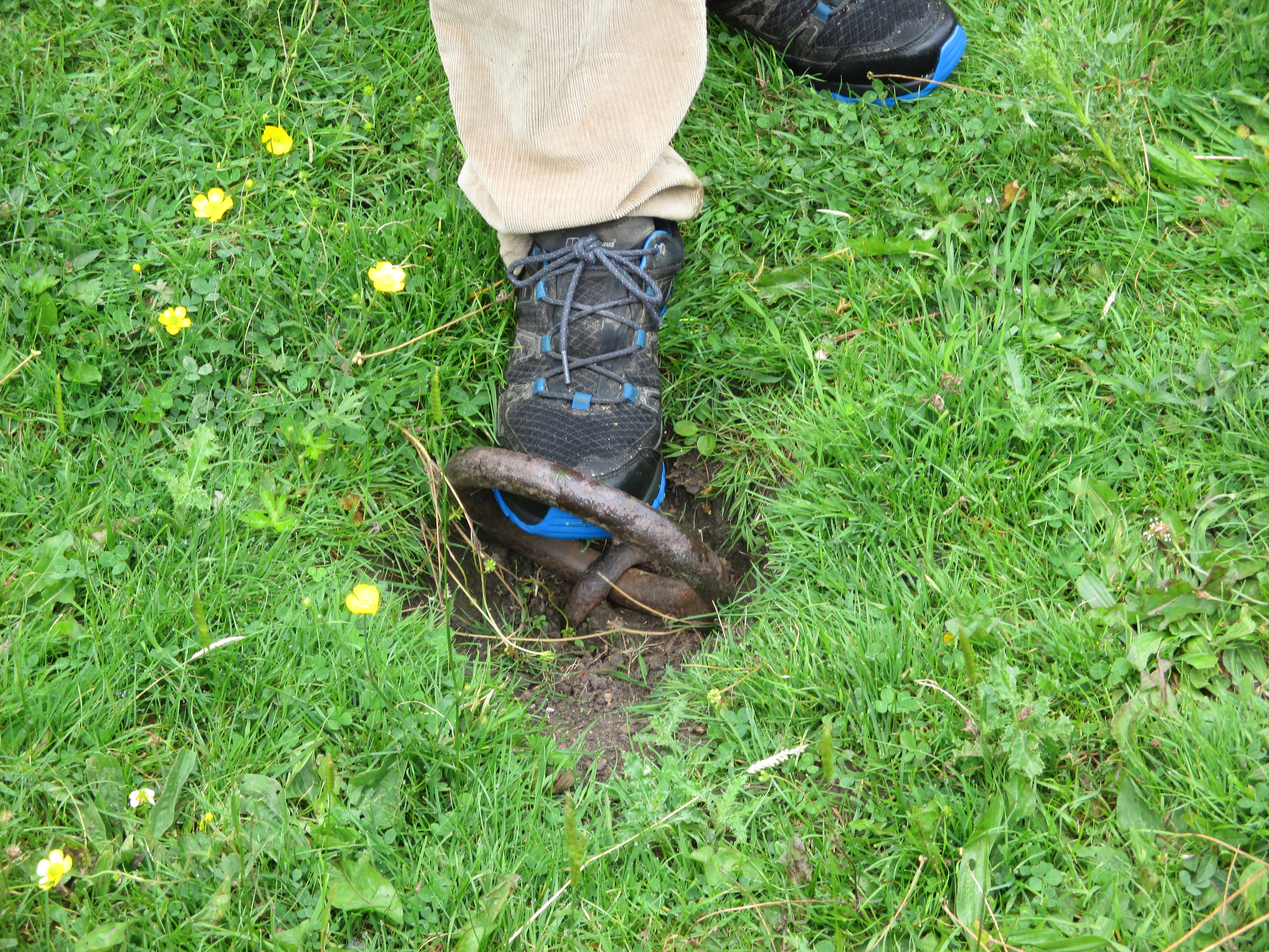
The bull-bating hook.
The second stop on our visit was the deserted village of Wharram Percy. Occupied almost continuously from the ninth century to the fifteenth, the village was then abandoned. There are some six thousand or so settlements of this type in Britain but few of them are so large or so well preserved. The nearest car park is some 750m away, so getting to the site requires a lengthy trek down an overgrown rocky slope which some members of our group found taxing. The land, overseen in its day by the Percy family (Earls of Northumberland, and relatives of Lord Percy Percy in the first two series of Blackadder) contains the church of St Martin, the outlines of several houses and, naturally, some more cows.
Having picnicked in the shade behind the minibus, we headed for Rudston Church. There lies the body of Winifred Holtby, the novelist and journalist best known for 1936’s South Riding, which was adapted to a BBC miniseries in 2011 (parts of which were filmed near my house).

The graveyard at Rudston Church
Our next stop was at Burton Agnes. Though the location is normally advertised for its grand Elizabethan stately home, we headed for the smaller Norman building to its side. The dark, uneven ground floor and tight helical stairway belie the vast dining room above, though the overall appearance was still somewhat spartan, with nothing but a long wooden table in an otherwise empty expanse.

Burton Agnes Norman Hall (left).
Finally we ventured to Skipsea Brough. Surrounded by grassland and yet more cows, this small hamlet features the motte of Skipsea Castle, built by Drogo de la Beuvrière circa 1086 to secure the region and its trading routes against an invasion by Denmark. The castle itself was destroyed following the rebellion of William de Forz in 1221. All that remains now is the artificial hill. The land was reclaimed for farming in the eighteenth century and taken over by the Office of Works in the twentieth.

The view from the Motte
It may perhaps appear strange that we closed out the academic term by wandering around the countryside, carefully evading deposits of Bovine faecal material while discussing medieval history, but in many ways it was a blessing that East Yorkshire had such rich locations to offer, and that we were able to visit them all with time left at the end of the day to visit the polling station. Though this day out may well be overshadowed in most people’s memories by the referendum, it will stand out as an example of what rural England has to offer as well as that which can survive the many tests of time. That last point may well prove more important than ever given what is about to come.
FURTHER READING
Beverley Westwood:
Wharram Percy:
- http://www.english-heritage.org.uk/visit/places/wharram-percy-deserted-medieval-village/
- https://www.dmv.hull.ac.uk/textpage.cfm?id=24
Rudston Church and Winifred Holtby:
Burton Agnes Norman Manor House:
- http://www.burtonagnes.com/Home.html
- http://www.english-heritage.org.uk/visit/places/burton-agnes-manor-house/
Skipsea Brough:

Pingback: Ten Years of Blogging | Robin Stanley Taylor